Shoring up New Zealand’s flood defences, from the sky
5 December 2023 | Read time: 6 minutes
SfTI funds innovative inundation mapping project that uses GPS data to monitor saturated soils.
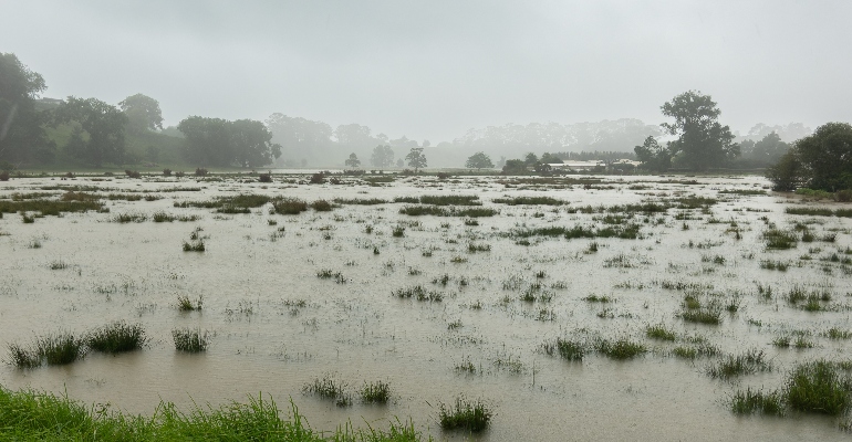
The summer months of 2023 broke many weather records here in Aotearoa New Zealand. Successive major events including cyclones and thunderstorms brought devastating flooding, which overwhelmed communities, damaged key infrastructure, and disrupted essential services across the motu. With ‘unprecedented’ events like these predicted to become more common in the next few decades, our flood monitoring and response systems will be under increasing pressure.
Dr Delwyn Moller from ReSTORe Lab is a researcher working on a world-first system that will aid in New Zealand’s future flood preparedness. And thanks to new funding from SfTI, awarded as part of our Ending With Impact project (EWIP) scheme, she and her team will be able to fast-track the system through some key development stages. The EWIPs are designed to focus on research that will have the biggest impact during the final months of the National Science Challenges, which all finish in June 2024. In a collaborative approach, the Resilience to Nature's Challenges NSC joined SfTI in recognising the huge potential impact of this project in terms of lifting our ability to prevent, adapt and respond to Aotearoa's weather-related threats.
An internationally-recognised radar expert, Project leader Dr Delwyn Moller has dedicated her career to the development of novel remote sensing systems that can help us better understand our own planet. She leads Rongowai (sensing water), a collaborative Earth science research project that brings together scientists from NZ and US universities (Auckland, Canterbury, Ohio State, and Michigan), NASA and Air New Zealand.
Rongowai relies on a technology called Global Navigation Satellite Systems reflectometry (GNSS-R). “In effect, we’re listening to the reflected signals from GPS and other navigation satellites,” explains Moller. As those
signals bounce off the surface of the Earth, they’re transformed by that interaction. And by analysing the reflected signal, you can gather information about the surface; from the extent of snow and ice in a region, to measurements of soil moisture or inundation from floods.
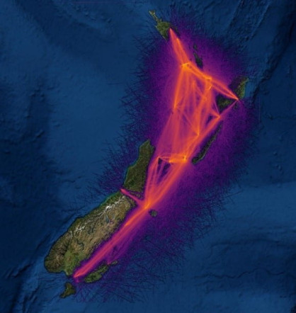
Data mapped across Aotearoa
“In effect, we’re listening to the reflected signals from GPS and other navigation satellites,”
Most GNSS-R receivers are flown on satellites orbiting the Earth. But the Rongowai receiver is installed on an existing commercial Air New Zealand aircraft. Each time the Q300 aircraft takes to the skies, the on-board receiver autonomously collects data, building up a detailed map of the surface. “We get seven hours of flying almost every day, which from a remote sensing viewpoint is transformational,” Moller says. “And because we're flying at lower altitudes, we get much higher resolution than we’d get from the same technology on board a satellite.” Unlike camera-based surveys, GNSS-R is unaffected by cloudy weather, and it can collect data day and night.
Though initially designed as one component of a global science system, the airborne GNSS-R also offers unique opportunities for studying the changing New Zealand landscape; particularly those regions that were so hard hit by the summer flooding. “We’re out in the field seeing what regional councils, Māori landowners and farmers are grappling with in those areas, in terms of food production and land resilience,” says Mike Taitoko, Rongowai project partner, and CEO of data visualisation and analytics platform Takiwā. “And it looks like things are going to get worse. So, we need to figure out how we can make better use of the regular feeds of high-resolution data, so that it can support those people; help them with their decision-making and future planning.”
“We’re out in the field seeing what regional councils, Māori landowners and farmers are grappling with in those areas, in terms of food production and land resilience,” says Mike Taitoko, Rongowai project partner, and CEO of data visualisation and analytics platform Takiwā. “And it looks like things are going to get worse. So, we need to figure out how we can make better use of the regular feeds of high-resolution data, so that it can support those people; help them with their decision-making and future planning.”
This is where the SfTI EWIP comes in. Over the next six months, it will allow Moller, Taitoko and the rest of the team to turn complex data on soil moisture and flood dynamics into visual images and maps that can be understood by anyone.
“This funding will allow us to put data together in a way that provides context for users,” says Taitoko. “We’ve seen that once you move outside the researcher's world, most people have no idea where to get data from, or how to use it to paint a richer picture that can help them make better decisions. That’s what we’re most excited about here – closing that last mile of data democratisation.”
“The EWIP will help us to engage directly with stakeholders,” says Moller. “To get pictures in front of people and say, ‘Hey, look at the potential here,’ while also developing a detailed understanding of their needs.”
She continues, “Ultimately, the project will help us to make that transition through what’s called the ‘valley of death’ in the R&D community. To ensure that what we’re doing will directly benefit New Zealanders while also hopefully having a global impact.”